
Whatsapp Hattı
Bizimle İletişime Geçin
Bizimle İletişime Geçin
 ULUSLARARASI GIDA VE TARIM KONFEDERASYONU ÜYESİDİR
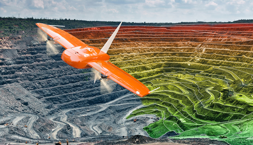
ADVANTAGES OF DRONE MAPPING APPLICATION
With Drone Mapping, it is possible to map very large areas in a short time, without sacrificing accuracy, at low cost.
v Time
v Cost
v Accuracy
v Sensitivity
AGRICULTURAL APPLICATIONS WITH DRONE MULTISPECTRAL IMAGE
Various studies are carried out for productivity analysis in agriculture by using DRON multispectral camera with RTK/GPS system, which has advantages in terms of time and economy in agricultural fields. As a result of the studies, the maps are periodically examined for product development or disease control. Precise coordinated photographs taken by UAV; First of all, image matching methods are balanced. 3D terrain model and ortho-mosaic images are obtained from this balanced dataset. By evaluating the obtained ortho-mosaic images, maps for product quality and yield such as NDVI (Normalized Plant Difference Index) are produced.